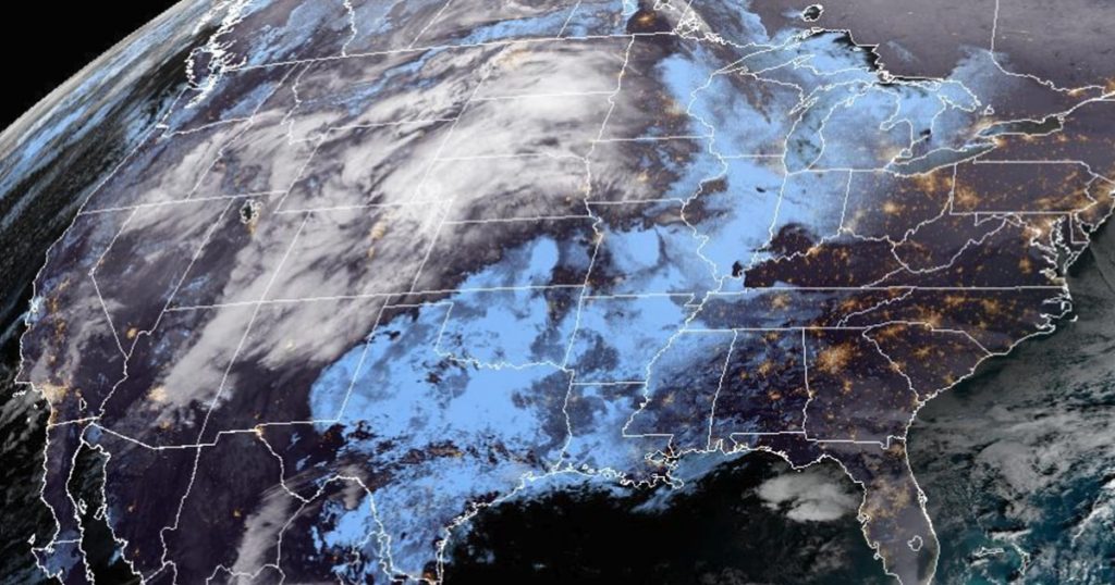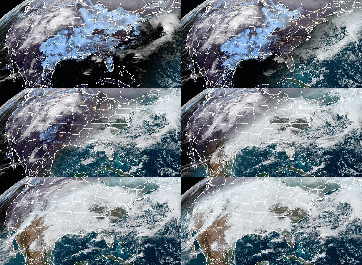

Parts of interstates in South Dakota were predicted to be closed Tuesday and law enforcement officials in the Plains urged drivers to rethink travel plans as a large winter storm has coated roads with snow and ice.
By late Monday, winter weather advisories affected more than 13 million people, from northern Nevada to northeastern Montana, and east to Wisconsin, according to the National Weather Service.
Blizzard warnings affected 519,000 more, mostly in Wyoming, Nebraska, Colorado and South Dakota.
“Please really evaluate which travels during your normal day are necessary and which ones can wait till this passes,” police in Sioux Falls, South Dakota’s largest city, warned. All state offices were ordered closed for Tuesday.
The winter storm had already dumped up to 4 feet of snow across the Sierra Nevada. The weather service called it a “massive storm system” that would affect the Central and Southern U.S. for days.
The South Dakota Transportation Department predicted that parts of Interstate 90 in the western part of the state and I-29 north of Brookings would need to be closed Tuesday.
Up to a foot of snow is expected to hit the Rockies, with winds gusting up to 50 mph. Blizzard warnings have been posted for eastern Wyoming, western Nebraska and northwest Kansas as conditions will start to deteriorate throughout Monday.
Up to 2 feet of snow could fall in parts of southwest South Dakota and northwest Nebraska through Wednesday, and 6 to 12 inches are expected throughout the rest of the region. Ice will also mix in, along with high wind gusts, making for treacherous travel conditions.
From Friday to Monday morning, 4 feet, 11 inches of snow fell in Truckee, California, north of Lake Tahoe, the weather service in Reno, Nevada, said. Things should be quieter this week, the agency predicted.
The system is forecast to push east Wednesday, when the snow and ice will move into the Great Lakes. The Ohio Valley will get rain before the storm will finally move to the Northeast by the end of the week.
On the southern side, severe storms are possible for the next three days.
The risk for severe weather Monday was centered in southwest Kansas and the Oklahoma Panhandle, where damaging winds up to 60 mph, large hail and a few tornadoes were possible.
By Tuesday, 8 million people from Houston to Mobile, Alabama, and up to Little Rock, Arkansas, are expected to be at risk for tornadoes, large hail and damaging winds. New Orleans; Baton Rouge, Louisiana; and Jackson, Mississippi, could also be at risk.
By Wednesday, the threat will shift east, where residents of New Orleans to the Florida Panhandle are at risk for damaging winds, large hail and a few tornadoes.
The storm is what meteorologists call an atmospheric river event, consisting of a column of condensed moisture, typically hundreds of feet wide, that can bring large amounts of rain and snow when it makes landfall, according to the National Oceanic and Atmospheric Administration.
 Latest Breaking News Online News Portal


