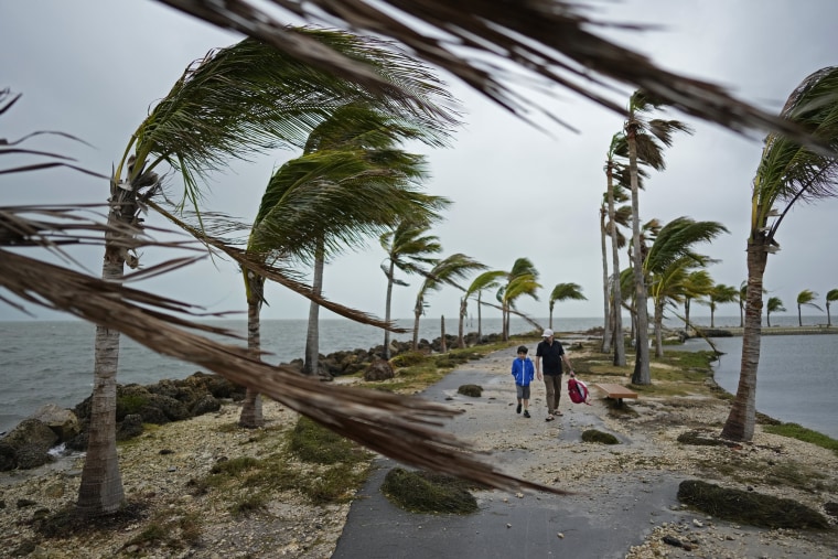
Cities along the East Coast are starting to feel some impacts from a major storm system that is expected to bring torrential rain, high winds and severe thunderstorms.
The system battered Florida and South Carolina this weekend, and its impacts are expected to last through Monday.
The rain brought coastal flooding to into the Tampa Bay area on Saturday, according to the National Weather Service Tampa Bay.

More than 33,000 customers in the state were without power by noon Sunday, according to PowerOutage.us, but that number dwindled drastically as power began being restored. By Sunday night, fewer than 2,000 were in the dark.
Charleston, South Carolina, broke daily rainfall records Sunday, with downtown Charleston recording 3.86 inches of rainfall, according to the weather service.
Charleston Harbor recorded a maximum tide of 9.86 feet — the fourth-highest tide on record and the highest tide not associated with a tropical system, the NWS noted.
The heavy rain has also led to several road closures downtown, and the Charleston Police Department has urged drivers to stay off the roads if possible.
Videos taken from Myrtle Beach and Cherry Grove in South Carolina showed street flooding and strong winds. Storm chaser Andrew Elswick shared the videos on X, writing that the winds were shaking his car.
“Most places look like this,” he said in one of the videos. “The water’s coming up pretty high.”
Moderate rainfall ahead of the system brought as much as 1.25 inches of rain to the Washington, D.C., area in a three-hour span Sunday night, with more expected, the National Weather Service office in Sterling, Virginia, said.
A flash flood watch was in effect for the region through 6 a.m. Monday, it said.
Weather service forecasters in Philadelphia said on social media platform X Sunday night, “The worst of the rain and winds will overspread the region over the next several hours.”
In New York City, the Metropolitan Transportation Authority is preparing crews for heavy rain and high wind gusts expected to come Sunday night, which may necessitate the removal of any trees that fall across train tracks.
Starting 10 p.m. Sunday and lasting until 2 p.m. Monday, the MTA will ban empty tractor-trailers and tandem trucks on bridges and in tunnels.
The city has also issued a travel advisory for Sunday and Monday, warning of likely coastal flooding up to 1 or 2 feet by Sunday night.
“With significant rainfall and high winds predicted for this Sunday into Monday, we want to remind New Yorkers to be alert, keep checking the forecast, and stay prepared,” Mayor Eric Adams said in a press release. “If you have loose things outside, now is a good time to secure them, before the winds start. People in low-lying and poor drainage areas should take extra precautions.”
Parts of Maine are also expecting heavy rain. The National Weather Service for Portland and Gray predicted “significant rainfall” Sunday night into Monday across mountains and foothills, leading to rises in rivers that flow from these mountains.
The weather service expects strong, potentially damaging winds to pick up on Monday as well. Coastal flooding is possible Monday during high tide, and more flooding is possible in inland areas from the rainfall and snowmelt.
Federal forecasters blame an “intense low pressure system” that was drawing precipitation from warmer Atlantic waters and spinning them up the coast. Cold air was expected to fill in as the storm passes, they said.
The clash of warm and cold may help to produce thunderstorms and feed heavy rain into the counterclockwise storm, which the weather service described as “intense.”
 Latest Breaking News Online News Portal


